Image credits here.
By Aaron Fiske
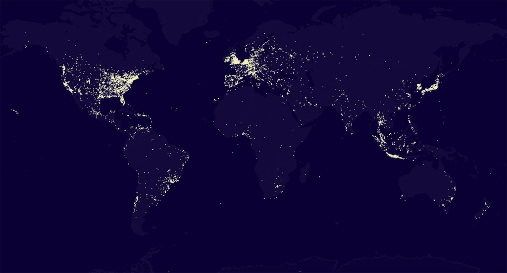
This image was generated by tracking approximately 250,000 geolocated tweets from the Twitter Streaming API, obtained over a twelve hour period starting around 0700 UTC on November 21, 2010. Each point of light represents a location which generated two or more tweets during the monitored time period. Brighter points indicate a greater tweet density (although the relationship between density and brightness is not linear). Data was collected using a Ruby script and compiled into the above image with a Java app and some retouching in Photoshop. Inspired by Frog Design's A World of Tweets.
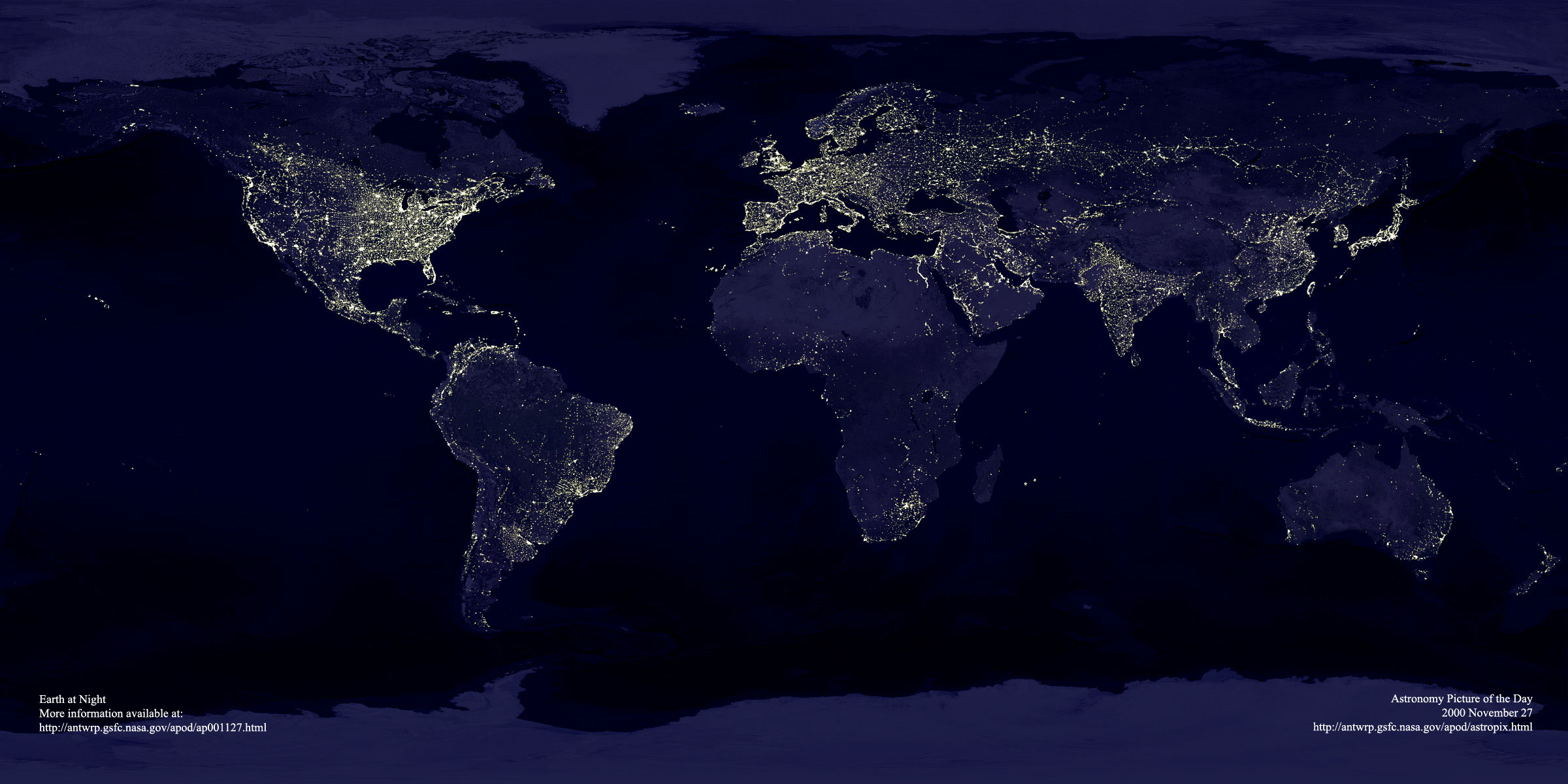
Compare to this well known composite image of Earth's light pollution (click for larger version):
Image credits here.
Copyright © 2010 Aaron Fiske